OGC API - Features
Audience
Students that are familiar with web services and APIs, and want to have an overview of OGC API - Features standard
Learning Objectives
At the completion of the module students will be able to:
- Explain what the OGC API - Features standard is
- Describe what can be done with OGC API - Features implementations
- Understand the main resources offered by OGC API - Features implementations
- Understand how to retrieve a description of the capabilities of an OGC API - Features implementation
- Understand how to issue requests to an implementation of OGC API - Features
- Be able to find an OGC API - Features endpoint and use it through a client
Introduction
OGC API - Features is a multi-part standard that offers the capability to create, modify, and query spatial data on the Web and specifies requirements and recommendations for APIs that want to follow a standard way of sharing feature data. OGC API - Features - Part 1: Core describes the mandatory capabilities that every implementing service must support and is restricted to read-access to spatial data. Additional capabilities like support for different CRS, richer queries and creating and modifying data are specified in additional parts.
Note
This tutorial module is not intended to be a replacement to the actual OGC API - Features - Part 1: Core standard. The tutorial intentionally focuses on a subset of capabilities in order to get the student started with using the standard. Please refer to the OGC API - Features - Part 1: Core standard for additional detail.
Background
History
While in draft form and prior to February 2019, OGC API - Features - Part 1: Core was referred to as WFS3.0.
Versions
OGC API - Features - Part 1: Core version 1.0.1, OGC API - Features - Part 2: Coordinate Reference Systems by Reference version 1.0.1 and OGC API - Features - Part 3: Filtering version 1.0.1 are the current latest versions
Test suite
Test suites are available for:
- OGC API - Features - Part 1
- OGC API - Features - Part 2
All of the test suites are available from the OGC Validator.
Implementations
Implementations can be found on the implementations page.
Usage
The standard provides a standard interface for requesting vector geospatial data consisting of geographic features and their properties. The benefit of this is that client applications can request source data from multiple implementations of the API, and then render the data for display or process the data further as part of a workflow. The standard enables the data to be accessed consistently with other data. Feature properties encoded using common data types such as text strings, date and time can also be accessed consistently.
- OGC API - Features - Part 1: Core specifies discovery and query operations that are implemented using the HTTP GET method. Support for additional methods (in particular POST, PUT, DELETE, PATCH) will be specified in additional parts. Government agencies, private organisations and academic institutes use this standard to publish vector geospatial datasets in a way that makes it easier for receiving organisations to compile new maps or conduct analysis on the supplied data. In Part 1 the default spatial Coordinate Reference System (CRS) is WGS 84 longitude/latitude with or without height.
-
OGC API - Features - Part 2: Coordinate Reference Systems By Reference extends Part 1 to support presenting geometry-valued properties in a response document in additional CRSs. Each supported CRS must be identified by a URI such as:
http://www.opengis.net/def/crs/EPSG/0/4326. -
OGC API - Features - Part 3: Filtering defines query parameters (
filter,filter-lang,filter-crs) to specify filter criteria in a request to an API and theQueryablesresource that declares the properties of data in a collection that can be used in filter expressions.
In addition to the approved parts above, The OGC API - Features Standards Working Group (SWG) is working on the following drafts:
-
Draft OGC API - Features - Part 4: Create, Replace, Update and Delete defines the behaviour of an API that allows resource instances to be added, replaced, modified and/or removed for a collection.
-
Draft OGC API - Features - Part 5/OGC API - Common - Part 3: Schemas specifies how features can be described by a logical schema and how such schemas are published in an OGC Web API implementation.
-
Draft OGC API - Features - Part 6: Property Selection specifies how the representation of a resource can be reduced to selected properties of the resource using a query parameter.
-
Draft OGC API - Features - Part 7: Geometry Simplification specifies how the representation of geometry can be simplified using a query parameter.
-
Draft OGC API - Features - Part 8: Sorting defines query parameters (sortby) to specify sorting criteria in a request to an API and the Sortables resource that declares the properties of data in a collection that can be used in sort by expressions.
-
Draft OGC API - Features - Part 9: Text Search adds a query parameter to the OGC API Features suite of standards to support text or keyword searches on text fields.
-
Draft OGC API - Features - Part 10: Search/Queries adds support to dynamically fetch features from multiple collections at a time.
Note
The rest of this tutorial will focus on the core part of the standard.
Relation to other OGC Standards
- OGC Web Feature Service Interface Standard (WFS): The WFS standard is more appropriate when working with client applications that only support classic OGC Web Services. Note as well that WFS adopts the Geography Markup Language (GML) as a default data format. In contrast, OGC API - Features includes recommendations to support HTML and GeoJSON as encodings, where practical. Implementations of OGC API - Features may also optionally support GML, as well as other vector formats.
Overview of Resources
OGC API - Features - Part 1: Core defines the resources listed in the following table.
| Resource | Method | Path | Purpose |
|---|---|---|---|
| Landing page | GET | / | This is the top-level resource, which serves as an entry point. |
| Conformance declaration | GET | /conformance | This resource presents information about the functionality that is implemented by the server. |
| API definition | GET | /api | This resource provides metadata about the API itself. Note use of /api on the server is optional and the API definition may be hosted on completely separate server. |
| Feature collections | GET | /collections | This resource lists the feature collections that are offered through the API. |
| Feature collection | GET | /collections/{collectionId} | This resource describes the feature collection identified in the path. |
| Features | GET | /collections/{collectionId}/items | This resource presents the features that are contained in the collection. |
| Feature | GET | /collections/{collectionId}/items/{featureId} | This resource presents the feature that is identified in the path |
Example
This demonstration server publishes vector geospatial data through an interface that conforms to OGC API - Features.
An example request that can be used to retrieve data from the Portuguese Points of Interest feature collection is https://demo.pygeoapi.io/master/collections/ogr_gpkg_poi/items?f=html
Note that the response to the request is HTML in this case.
Alternatively, the same data can be retrieved in GeoJSON format, through the request https://demo.pygeoapi.io/master/collections/ogr_gpkg_poi/items?f=json
A client application can then retrieve the GeoJSON document and display or process it.
Resources
This section provides basic information about the types of resources that OGC API - Features offers.
Each resource provides links to related resources. This enables a
client application to navigate the resources, from the landing page
through to the individual features. The server identifies the
relationship between a resource and other linked resources through a
link relation type, represented by the attribute rel. The link
relation types used by implementations of the OGC API - Features -
Part 1: Core can be found in Section
5.2
of the standard.
Landing page
The landing page is the top-level resource that serves as an entry point. A client application needs to know the location of the landing page of the server. From the landing page, the client application can then retrieve links to the Conformance declaration, Collection and API definition paths. An example landing page is at https://demo.ldproxy.net/daraa?f=json
The link to the API definition is identified through the
service-desc and service-doc link relation types.
The link to the Conformance declaration is identified through the
conformance link relation type.
The link to the Collections is identified through the data link
relation type.
An extract from the landing page of a demo server is shown below.
{
  "title": "Daraa",
  "description": "This is a test dataset used in the Open Portrayal Framework thread in the OGC Testbed-15 as well as the OGC Vector Tiles Pilot Phase 2. The data is based on OpenStreetMap data from the region of Daraa, Syria, converted to the Topographic Data Store schema of NGA.",
  "attribution": "US National Geospatial Intelligence Agency (NGA)",
  "links": [
    {
      "rel": "self",
      "type": "application/json",
      "title": "This document",
      "href": "https://demo.ldproxy.net/daraa?f=json"
    },
    {
      "rel": "service-desc",
      "type": "application/vnd.oai.openapi+json;version=3.0",
      "title": "Definition of the API in OpenAPI 3.0",
      "href": "https://demo.ldproxy.net/daraa/api?f=json"
    },
    {
      "rel": "conformance",
      "title": "OGC API conformance classes implemented by this server",
      "href": "https://demo.ldproxy.net/daraa/conformance"
    },
    {
      "rel": "data",
      "title": "Access the data",
      "href": "https://demo.ldproxy.net/daraa/collections"
    }
  ]
}
Conformance declarations
An implementation of OGC API - Features describes the capabilities that it supports by declaring which conformance classes it implements. The Conformance declaration states the conformance classes from standards or community specifications, identified by a URI, that the API conforms to. Clients can then use this information, although they are not required to. Accessing the Conformance declaration using HTTP GET returns the list of URIs of conformance classes implemented by the server. Conformance classes describe the behavior a server should implement in order to meet one or more sets of requirements specified in a standard.
Below is an extract from the response to the request https://demo.ldproxy.net/daraa/conformance?f=json
Notice that the example shows a link relation type called alternate
which identifies a way to retrieve an alternative representation of the
information provided by the resource. In this case the alternate
link relation is referencing an HTML representation of the conformance
declaration.
{
  "links": [
    {
      "rel": "alternate",
      "type": "text/html",
      "title": "This document as HTML",
      "href": "https://demo.ldproxy.net/daraa/conformance?f=html"
    },
    {
      "rel": "self",
      "type": "application/json",
      "title": "This document",
      "href": "https://demo.ldproxy.net/daraa/conformance?f=json"
    }
  ]
"conformsTo" : ["http://www.opengis.net/spec/ogcapi-features-1/1.0/conf/core", "http://www.opengis.net/spec/ogcapi-features-1/1.0/conf/geojson", "http://www.opengis.net/spec/ogcapi-features-1/1.0/conf/html", "http://www.opengis.net/spec/ogcapi-features-1/1.0/conf/oas30", "http://www.opengis.net/spec/ogcapi-features-2/1.0/conf/crs", "http://www.opengis.net/spec/ogcapi-features-3/0.0/conf/features-filter", "http://www.opengis.net/spec/ogcapi-features-3/0.0/conf/filter", "http://www.opengis.net/spec/ogcapi-features-3/0.0/conf/queryables", "http://www.opengis.net/spec/ogcapi-features-3/0.0/conf/queryables-query-parameters"]
}
API Definition
The API definition describes the capabilities of the server. It can be used by developers to understand the API, by software clients to connect to the server, or by development tools to support the implementation of servers and clients. Accessing the API definition using HTTP GET returns a description of the API.
There are conformance classes to provide the API definition using Open API. Some servers also return a human-readable representation of the definition in HTML, using tools such as Redoc or Swagger.
This is an extract of an API definition, which uses Open API 3:
{
  "openapi" : "3.0.3",
  "info" : {
    "title" : "Daraa",
    "description" : "This is a test dataset used in the Open Portrayal Framework thread in the OGC Testbed-15 as well as the OGC Vector Tiles Pilot Phase 2. The data is based on OpenStreetMap data from the region of Daraa, Syria, converted to the Topographic Data Store schema of NGA.\n\n_Note: This API is based on API building blocks (e.g., operations, query parameters, or headers) specified in OGC API Standards or drafts of those standards. For more information about OGC API Standards, see [https://ogcapi.ogc.org](https://ogcapi.ogc.org/). Some building blocks of this API can be preliminary and may change in this API, because they are not yet based on a stable specification. The maturity is stated for each building block._",
    "contact" : {
      "name" : "interactive instruments GmbH",
      "email" : "mail@interactive-instruments.de"
    },
    "license" : {
      "name" : "The dataset was provided by the US National Geospatial Intelligence Agency (NGA) for development, testing and demonstrations in initiatives of the Open Geospatial Consortium (OGC). For any reuse of the data outside this API, please contact NGA."
    },
    "version" : "1.0.0"
  },
  "servers" : [ {
    "url" : "https://demo.ldproxy.net/daraa"
  } ],
  "tags" : [ ],
  "paths" : {
    "/" : {
      "get" : {
        "tags" : [ "Capabilities" ],
        "summary" : "landing page",
        "description" : "The landing page provides links to the API definition (link relations `service-desc` and `service-doc`), the Conformance declaration (path `/conformance`, link relation `conformance`), and other resources in the API.\n\n_Maturity: `STABLE`_",
        "externalDocs" : {
          "description" : "The specification that describes this operation: OGC API - Features - Part 1: Core",
          "url" : "https://docs.ogc.org/is/17-069r4/17-069r4.html"
        },
        "operationId" : "getLandingPage",
        "parameters" : [ {
          "$ref" : "#/components/parameters/fCommon"
        } ],
        "responses" : {
          "200" : {
            "description" : "The operation was executed successfully.",
            "content" : {
              "application/json" : {
                "schema" : {
                  "$ref" : "#/components/schemas/LandingPage"
                }
              },
              "text/html" : {
                "schema" : {
                  "$ref" : "#/components/schemas/htmlSchema"
                }
              }
            }
          },
          "400" : {
            "description" : "Bad Request"
          },
          "406" : {
            "description" : "Not Acceptable"
          },
          "500" : {
            "description" : "Server Error"
          }
        },
        "x-maturity" : "STABLE_OGC"
      }
    },
Note
The use of /api on the server is optional and the API definition may be hosted in a different path or on completely separate server.
Feature collections
Data offered through an implementation of OGC API - Features - Part 1:
Core is organized into one or more feature collections. The
Collections resource provides information about and access to the
list of collections.
For each collection, there is a link to the detailed description of the collection (represented by the path /collections/{collectionId} and link relation self).
For each collection, there is a link to the features in the collection (represented by the path /collections/{collectionId}/items and link relation items) and other information about the collection. The following information is provided by the server to describe each collection:
- A local identifier for the collection that is unique for the dataset
- A list of coordinate reference systems (CRS) in which geometries may be returned by the server
- An optional title and description for the collection
- An optional extent that can be used to provide an indication of the spatial and temporal extent of the collection
- An optional indicator about the type of the items in the collection
(the default value, if the indicator is not provided, is
feature).
Below is an extract from the response to the request https://demo.ldproxy.net/daraa/collections?f=json
{
  "title": "Daraa",
  "description": "This is a test dataset used in the Open Portrayal Framework thread in the OGC Testbed-15 as well as the OGC Vector Tiles Pilot Phase 2. The data is based on OpenStreetMap data from the region of Daraa, Syria, converted to the Topographic Data Store schema of NGA.",
  "collections": [
    {
      "title": "Aeronautic (Curves)",
      "description": "Aeronautical Facilities: Information about an area specifically designed and constructed for landing, accommodating, and launching military and/or civilian aircraft, rockets, missiles and/or spacecraft.<br/>Aeronautical Aids to Navigation: Information about electronic equipment, housings, and utilities that provide positional information for direction or otherwise assisting in the navigation of airborne aircraft.",
      "id": "AeronauticCrv",
      "extent": {
        "spatial": {
          "bbox": [
            [36.395158, 32.693301, 36.430814, 32.717333]
          ],
          "crs": "http://www.opengis.net/def/crs/OGC/1.3/CRS84"
        },
      "storageCrs": "http://www.opengis.net/def/crs/OGC/1.3/CRS84",
      "links": [
        {
          "rel": "items",
          "type": "application/geo+json",
          "title": "Access the features in the collection 'Aeronautic (Curves)' as GeoJSON",
          "href": "https://demo.ldproxy.net/daraa/collections/AeronauticCrv/items?f=json"
        },
        {
          "rel": "self",
          "title": "The 'Aeronautic (Curves)' feature collection",
          "href": "https://demo.ldproxy.net/daraa/collections/AeronauticCrv"
        }
      ]
     }
    },
    {
      "title": "Other (Points)",
      "id": "o2s_p",
      "extent": {
        "spatial": {
          "bbox": [
            [35.939604, 32.544963, 36.443695, 32.984648]
          ],
          "crs": "http://www.opengis.net/def/crs/OGC/1.3/CRS84"
        }
      },
      "storageCrs": "http://www.opengis.net/def/crs/OGC/1.3/CRS84",
      "links": [
        {
          "rel": "items",
          "type": "application/geo+json",
          "title": "Access the features in the collection 'Other (Points)' as GeoJSON",
          "href": "https://demo.ldproxy.net/daraa/collections/o2s_p/items?f=json"
        },
        {
          "rel": "self",
          "title": "The 'Other (Points)' feature collection",
          "href": "https://demo.ldproxy.net/daraa/collections/o2s_p"
        }
      ],
    }
  ]
Feature collection
The Collection resource provides detailed information about the collection identified in a request.
Below is an extract from the response to the request https://demo.ldproxy.net/daraa/collections/AeronauticCrv?f=json
{
  "title": "Aeronautic (Curves)",
  "description": "Aeronautical Facilities: Information about an area specifically designed and constructed for landing, accommodating, and launching military and/or civilian aircraft, rockets, missiles and/or spacecraft.<br/>Aeronautical Aids to Navigation: Information about electronic equipment, housings, and utilities that provide positional information for direction or otherwise assisting in the navigation of airborne aircraft.",
  "id": "AeronauticCrv",
  "extent": {
    "spatial": {
      "bbox": [
        [36.395158, 32.693301, 36.430814, 32.717333]
      ],
      "crs": "http://www.opengis.net/def/crs/OGC/1.3/CRS84"
    },
    "temporal": {
      "interval": [
        [
          "2011-03-16T14:51:12Z",
          "2015-09-11T19:15:35Z"
        ]
      ],
      "trs": "http://www.opengis.net/def/uom/ISO-8601/0/Gregorian"
    }
  },
  "itemType": "feature",
  "crs": [
    "http://www.opengis.net/def/crs/OGC/1.3/CRS84",
    "http://www.opengis.net/def/crs/EPSG/0/3395",
    "http://www.opengis.net/def/crs/EPSG/0/3857",
    "http://www.opengis.net/def/crs/EPSG/0/4326"
  ],
  "storageCrs": "http://www.opengis.net/def/crs/OGC/1.3/CRS84",
  "links": [
    {
      "rel": "items",
      "type": "application/geo+json",
      "title": "Access the features in the collection 'Aeronautic (Curves)' as GeoJSON",
      "href": "https://demo.ldproxy.net/daraa/collections/AeronauticCrv/items?f=json"
    }
    {
      "rel": "self",
      "type": "application/json",
      "title": "This document",
      "href": "https://demo.ldproxy.net/daraa/collections/AeronauticCrv?f=json"
    }
  ],
}
Features
The Features resource returns a document consisting of features contained by the collection identified in a request. The features included in the response are determined by the server based on the query parameters of the request. To support access to larger collections without overloading the client, the API supports paged access with links to the next page, if more features are selected than the page size.
Below is an extract from the response to the request https://demo.ldproxy.net/daraa/collections/AeronauticCrv/items?f=json
{
  "type": "FeatureCollection",
  "numberReturned": 10,
  "numberMatched": 20,
  "timeStamp": "2023-11-29T08:38:10Z",
  "features": [
    {
      "type": "Feature",
      "id": 1,
      "geometry": {
        "type": "MultiLineString",
        "coordinates": [[[36.4270030, 32.7114540],[36.4251990, 32.7137030]]]
      },
      "properties": {
        "F_CODE": "GB075",
        "ZI001_SDV": "2011-03-16T14:51:12Z",
        "UFI": "2d008c34-4458-4226-b335-cf903d261ce9",
        "ZI005_FNA": "No Information",
        "FCSUBTYPE": 100454
      }
    },
    {
      "type": "Feature",
      "id": 2,
      "geometry": {
        "type": "MultiLineString",
        "coordinates": [
          [[ 36.4009090, 32.7000770 ],
            [ 36.4031330, 32.7013330 ],
            [ 36.4208880, 32.7113020 ],
            [ 36.4231110, 32.7125400 ],
            [ 36.4251990, 32.7137030 ],
            [ 36.4252970, 32.7137690 ]
          ]
        ]
      },
      "properties": {
        "F_CODE": "GB075",
        "ZI001_SDV": "2015-09-11T19:15:35Z",
        "UFI": "1257bf27-3f91-461d-8a3b-a95af2ea1f5a",
        "ZI005_FNA": "No Information",
        "FCSUBTYPE": 100454
      }
    }]
}
Note that this document is a valid GeoJSON document.
Additional parameters may be used to select only a subset of the features in the collection.
A bbox or datetime parameter may be used to select only the subset of the features in the collection that are within the bounding box specified by the bbox parameter or the time interval specified by the datetime parameter. An example request that uses the bbox parameter is https://demo.ldproxy.net/daraa/collections/VegetationSrf/items?f=json&bbox=36.0832432,32.599852,36.1168237,32.6283697
Note
The effect of the bbox parameter can be easily seen when comparing the HTML response from applying the bbox parameter to the response without any bbox parameter.
The limit parameter may be used to control the page size by specifying the maximum number of features that should be returned in the response. An example request that uses the limit parameter is https://demo.ldproxy.net/daraa/collections/AeronauticCrv/items?f=json&limit=2
Each page may include information about the number of selected and
returned features (numberMatched and numberReturned) as well as
links to support paging (link relation next).
Feature
The Feature resource is used for retrieving an individual feature, its
geometric representation and other properties. In the example below, the
feature with an id of 1 is retrieved. The response is retrieved
through the request
https://demo.ldproxy.net/daraa/collections/AeronauticCrv/items/1?f=json
{
  "type": "Feature",
  "id": 1,
  "geometry": {
    "type": "MultiLineString",
    "coordinates": [
      [
        [
          36.4270030,
          32.7114540
        ],
        [
          36.4251990,
          32.7137030
        ]
      ]
    ]
  },
  "properties": {
    "F_CODE": "GB075",
    "ZI001_SDV": "2011-03-16T14:51:12Z",
    "UFI": "2d008c34-4458-4226-b335-cf903d261ce9",
    "ZI005_FNA": "No Information",
    "FCSUBTYPE": 100454
  },
  "links": [
    {
      "href": "https://demo.ldproxy.net/daraa/collections/AeronauticCrv/items/1?f=json",
      "rel": "self",
      "type": "application/geo+json",
      "title": "This document"
    },
    {
      "href": "https://demo.ldproxy.net/daraa/collections/AeronauticCrv/items/1?f=jsonfgc",
      "rel": "alternate",
      "type": "application/vnd.ogc.fg+json;compatibility=geojson",
      "title": "This document as JSON-FG (GeoJSON Compatibility Mode)"
    },
    {
      "href": "https://demo.ldproxy.net/daraa/collections/AeronauticCrv/items/1?f=csv",
      "rel": "alternate",
      "type": "text/csv",
      "title": "This document as CSV"
    },
    {
      "href": "https://demo.ldproxy.net/daraa/collections/AeronauticCrv/items/1?f=fgb",
      "rel": "alternate",
      "type": "application/flatgeobuf",
      "title": "This document as FlatGeobuf"
    },
    {
      "href": "https://demo.ldproxy.net/daraa/collections/AeronauticCrv/items/1?f=html",
      "rel": "alternate",
      "type": "text/html",
      "title": "This document as HTML"
    },
    {
      "href": "https://demo.ldproxy.net/daraa/collections/AeronauticCrv/items/1?f=jsonfg",
      "rel": "alternate",
      "type": "application/vnd.ogc.fg+json",
      "title": "This document as JSON-FG"
    },
    {
      "href": "https://demo.ldproxy.net/daraa/collections/AeronauticCrv?f=json",
      "rel": "collection",
      "type": "application/json",
      "title": "The collection the feature belongs to"
    }
  ]
}
Client usage
In this workshop we'll cover different OGC API - Features client tools two JavaScript libraries ( Leaflet and OpenLayers ), one desktop GIS (QGIS) and a C++ library (GDAL).
Leaflet
Leaflet can read GeoJSON out-of-the-box, from a file or an API. As OGC API - Features can expose data as GeoJSON by using f=json in the request, the response can be read directly in LeafLet using the following code:
fetch('https://demo.ldproxy.net/zoomstack/collections/airports/items?limit=100', {
    headers: {
      'Accept': 'application/geo+json'
    }
  }).then(response => response.json())
  .then(data => {
  L.geoJSON(data).addTo(map);
});
Leaflet also has an external plugin which allows OGC API - Features to be used natively:
// Import following in <head> tag
//   <script src='https://unpkg.com/leaflet-featuregroup-ogcapi@0.1.0/Leaflet.FeatureGroup.OGCAPI.js'></script>


var overlay = L.featureGroup.ogcApi("https://demo.ldproxy.net/zoomstack/", {
    collection: "airports",
    limit: 500,
    padding: 0.2
}).addTo(map);
OpenLayers
OpenLayers also understands GeoJSON by default. An OGC API - Features response can be consumed using the following code:
fetch('https://demo.ldproxy.net/zoomstack/collections/airports/items?limit=100', {
    headers: {
      'Accept': 'application/geo+json'
    }
  }).then(response => response.json())
  .then(data => {
  map.addLayer(new ol.layer.Vector({
    source: new ol.source.Vector({
      features: new ol.format.GeoJSON().readFeatures(data, { featureProjection: 'EPSG:3857' }),
      attributions: 'Contains OS data © Crown copyright and database right 2021.'
    })
  }));
});
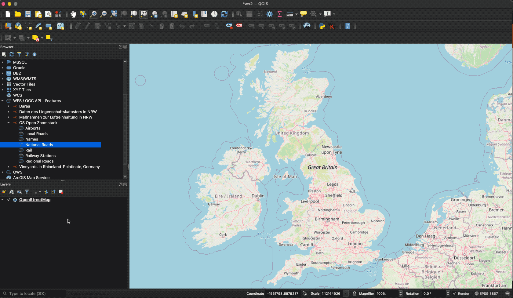
QGIS
QGIS supports OGC API - Features and WFS using the same vector layer provider. Open the Data Source Manager and go to the "WFS / OGC API Features" tab.
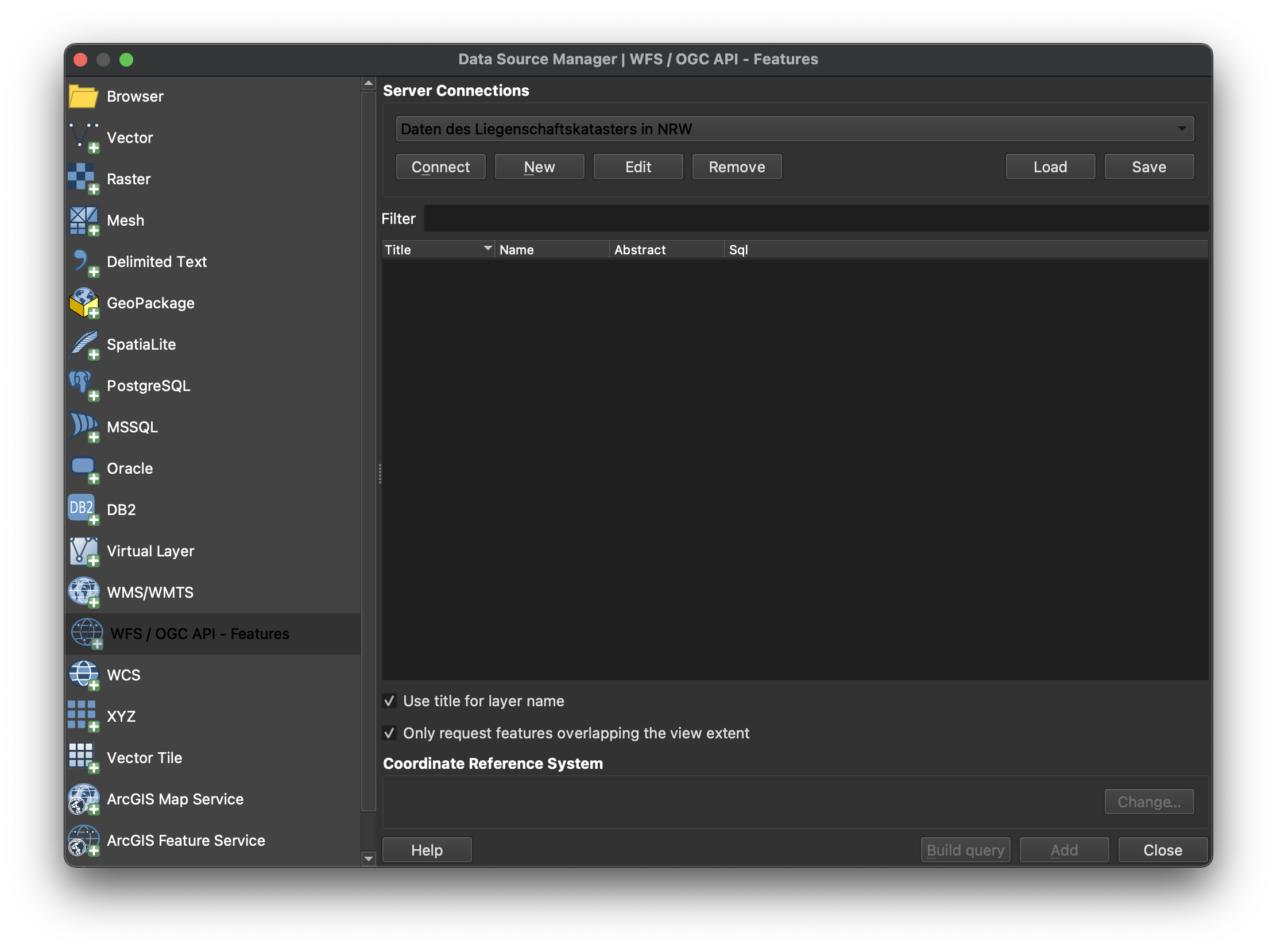
Provide the connection information. The URL is the URL of the OGC API landing page resource (in this case https://demo.ldproxy.net/zoomstack). Make sure "Enable feature paging" is checked.
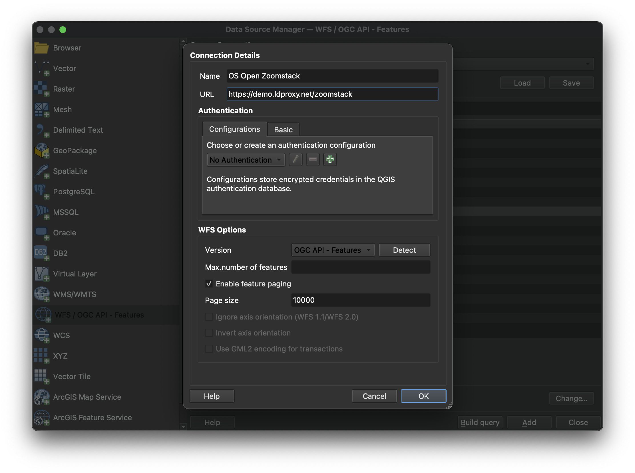
Note that, if a collection has millions of features and the map view covers the extent of the collection, QGIS will try to load all features. To avoid this, you can, for example, restrict the scale range in which the layer should be visible.
GDAL
GDAL supports OGC API - Features as core vector format. The below example demonstrates usage via ogrinfo against an OGC API - Features endpoint:
ogrinfo OAPIF:https://demo.ldproxy.net/zoomstack
INFO: Open of `OAPIF:https://demo.ldproxy.net/zoomstack'
      using driver `OAPIF' successful.
1: airports (title: Airports) (Point)
2: boundaries (title: Boundaries) (Line String)
3: contours (title: Contours) (Line String)
4: district_buildings (title: District Buildings) (Polygon)
5: etl (title: ETL) (Line String)
6: foreshore (title: Foreshore) (Polygon)
7: greenspace (title: Greenspace) (Polygon)
8: land (title: Land) (Polygon)
9: local_buildings (title: Local Buildings) (Polygon)
10: names (title: Names) (Point)
11: national_parks (title: National Parks) (Polygon)
12: rail (title: Rail) (Line String)
13: railway_stations (title: RailwayStation) (Point)
14: roads_local (title: Local Roads) (Line String)
15: roads_national (title: National Roads) (Line String)
16: roads_regional (title: Regional Roads) (Line String)
17: sites (title: Sites) (Multi Polygon)
18: surfacewater (title: Surface Water) (Polygon)
19: urban_areas (title: Urban Areas) (Polygon)
20: waterlines (title: Waterlines) (Line String)
21: woodland (title: Woodland) (Polygon)
GeoJSON
The OGC API - Features GeoJSON Requirements Class specifies a GeoJSON based encoding for based on RFC7946. Given the ubiquity of GeoJSON, numerous tools exist to validate process and decode/encode GeoJSON, making OGC API - Features GeoJSON easy to include in data processing pipelines. OGC API - Features includes the JSON Schema for the GeoJSON representation and thus can be used for runtime or offline validation of data payloads. Applications based on OGC API - Features GeoJSON can extend and constrain the schema accordingly for domain specific workflows.
Summary
OGC API - Features provides functionality for working with vector data on the Web. This deep dive provided an overview of the standard and the various Resources and endpoints that are supported, as well as example of how-to access it using different clients.